-
Archives
-
Meta
Drone aerial inspection services -Visual and Thermal imaging
Home » Drone aerial inspection services -Visual and Thermal imaging
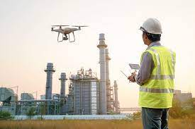
Drone inspection makes it possible to access areas that may pose health, safety and environmental risks in a fast and safe way.
Benefits of drone inspection –
Using our drone inspection services for visual inspection, provide benefits such as:
Inspection of areas difficult to access
Preventive maintenance planning and optimised production
Access to areas that pose health, safety and environmental risk to humans
Quick on-site deployment of the drone inspection system
Authorised and qualified UAV-inspection personnel
Reduced downtime.
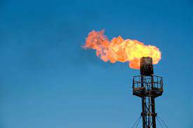
UAV of offshore oil and gas towers and flares –
The offshore environment is often regarded as tough and demanding, where it is vital to keep faults as well as loss of production at both the installation and the inspection equipment to a minimum.
Drone inspection enables both pilot and NDT personnel to distance themselves from the danger zones, making safe inspection of high risk areas possible. Furthermore, detailed images of critical components can be obtained, without shutdown or disturbance of the production process.
One example of an assignment containing these elements is inspection of the flare and the flare tower on an oil/gas platform with an active flare. Here the drone collects images or thermographic data of critical components on the flare and the flare tower, while production continues unaffected.
The data collection takes place in a turbulent and flame-filled environment, whilst the drone pilot, inspector and employees are at a safe distance from the inspection area.
Bridge inspection by drone –
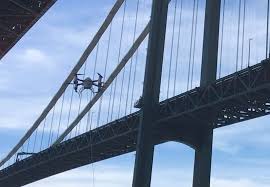
FORCE Technology’s inspection drone is capable of viewing an item at any angle between +45° up and 90° down. The drone’s ability to look up is particularly useful when inspecting bridges offshore. Flying underneath the bridge and inspecting for corrosion etc. without the cost of e.g. a rope access team makes aerial inspection an attractive alternative.
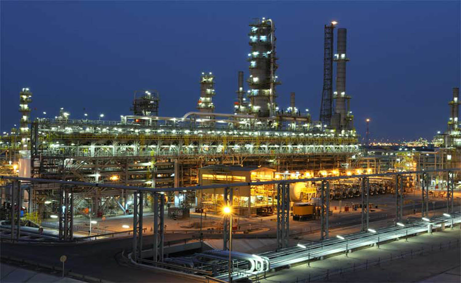
Refineries – storage tanks and confined spaces
Drone inspection of boilers, fuel storage tanks and confined spaces at power plants, refineries and other industrial plants is becoming commonplace. Here visual inspections are advantageous as it often is too expensive or time consuming to set up scaffolding, or too hazardous for physical inspection.
There are though considerable challenges when using drones in confined spaces, these include lack of proper lighting, colour nuances, radio signal reflection and propeller turbulence.
We meet these challenges by using powerful LED lamps, thus ensuring good picture quality with true, natural colours, as well as using specialised equipment and experienced pilots who can predict areas with high risk of turbulence.
The quick deployment time and ability to either screen a whole area or quickly get details of specific sections make drone inspection ideal for time critical inspection.
The data provided by the drone inspection can significantly improve the maintenance planning, as it can be used to reduce maintenance related downtime and costs.
OTHER INSPECTIONS
Aerial inspection has proven to be an invaluable aid in other applications, such as critical infrastructure agriculture, and first responders.
Solar Panels and Solar Farms
Wind Turbines and Wind Farms
Natural Gas, Chemical and other Industrial Storage tanks
Agriculture
Cell Towers
Firefighting
Search and Rescue
Road, infrastructure and construction inspections
DRONE THERMAL IMAGING –
We already know that drone thermal cameras can be used in a variety of ways, more so with its wider market reach. Let’s find out its most popular uses as we divide them by category below.
Roof and Building Inspections –
As you can imagine, drone thermal imaging is incredibly efficient in inspecting residential and commercial exteriors. It’s great for scanning leaks and finding sources of energy inefficiencies and exterior issues. For homes, this can save you a lot of money in heating and bigger repair costs that can result from delayed detection of water and structural damage.
Drones also shorten inspections of large roof decks to just a few minutes, especially if the drone will fly high enough (under the legal limit) to get a view of the entire roof or building and fly lower if there are problem areas that need more detailed imagery.
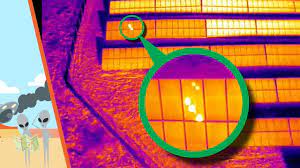
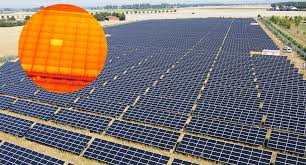
Solar Field Inspections –
Like commercial roof inspections, solar field inspections can take a lot of time if they were to be inspected manually by foot. Drones can evaluate a large solar area in a fraction of the time and cost from high up in the air, as well as use its high sensitivity features to track cell defects and obtain accurate readings of other specific problem areas on a more regular basis.
Electrical Inspections –
With thermal cameras and certified drone operators, electrical facilities — including substations, power lines, and power distribution systems — can be monitored and examined for overheating spots, damaged components, and faulty connections from a safe distance without the need for expensive equipment or putting lives at risk.
Drones save a lot of time and cost by limiting the number of engineers to just a few drone pilots and flight controllers with built-in or remote displays to carry out the operation — even in hard to reach areas.
Oil and Gas –
Under the oil and gas category are two specific areas of application: refinery and pipeline inspection. For refinery inspections, thermal imaging drones are equipped with optical gas imaging (OGI) sensors and can conveniently quantify leaks from a safe distance. Pipeline inspections, on the other hand, use fixed-wing drones with greater operational performance.
Both applications cost significantly less compared to the traditional use of manned aircraft. Aside from capturing high-resolution images, many thermal imaging drones can also stitch multiple images into an orthomosaic map to provide both a broad overview and more detailed information that reveal problem spots as well as the life cycle of specific components for analysis.